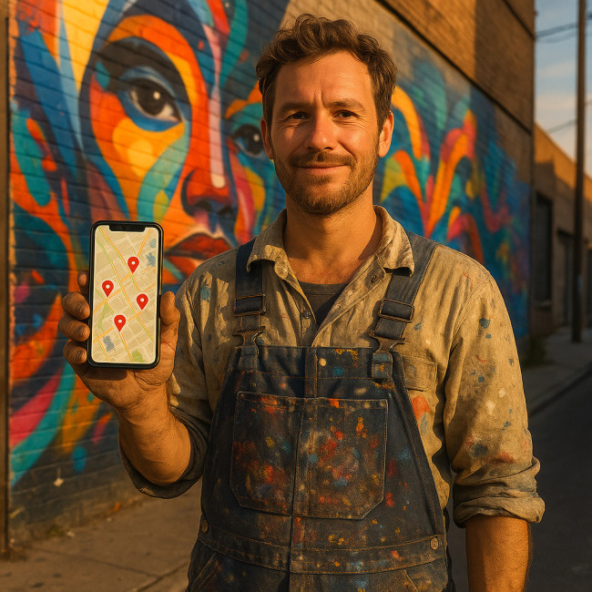
Geo-tagging finished murals: map your walls online to spark fresh commissions
Want your street art to do the prospecting while you paint the next wall? Geo-tagging finished murals pins each piece on an online map, making it discoverable to brands, curators and city planners hunting for talent nearby. Follow this guide to transform past work into a location-powered portfolio that attracts steady commissions without extra cold outreach.
Why geo-tagging murals unlocks new business
Most recruiters search locally first. A mural that is geo-tagged appears in “near me” results, navigation apps and curated art maps. That visibility delivers three measurable wins:
- Walk-by traffic turns digital: Visitors post and share the map pin, multiplying organic reach.
- Data-backed credibility: A mapped history of walls proves consistency when you negotiate budgets (pair this with the advice in budget-builder checklists).
- Instant relevance: City councils and brands filter creators by radius. A live pin keeps you on every shortlist.
How geo-tags work — plain English version
1. GPS coordinates
Your smartphone or drone records latitude and longitude. Most mapping tools embed these numbers automatically.
2. Metadata injection
The coordinates are written into the image file's EXIF data or added as a separate field if you upload via a platform's form.
3. Indexing and search
Google Maps, Instagram, OpenStreetMap and specialised art directories read the coordinates and surface the post when users zoom into that area.
Step-by-step: map your murals in under an hour
- Gather high-resolution photos. Aim for at least 3000 px on the long edge to stay crisp when users zoom.
- Verify location accuracy. Stand directly in front of the mural, open your camera app, and note the GPS stamp.
- Edit and compress. Keep JPGs under 1 MB so mapping layers load fast on mobile.
- Add coordinates to EXIF. Free tools like GeoSetter or Lightroom's Map module do this in seconds.
- Upload to a mapping platform (see comparison table below) and complete title, description and alt text—including the keyword “geo-tagging finished murals”.
- Embed the map on your website or your Artfolio showcase.
Platform comparison: where to pin your work
| Platform | Cost | Max image size | Extra reach perks |
|---|---|---|---|
| Google Maps Listing | Free | 5 MB | Shows on general navigation searches |
| Instagram Photo Map | Free | 30 MB | Built-in audience + hashtags |
| Mapme Art Trail | $19 / month | 10 MB | Custom branding + analytics |
| StreetArtCities | Free | 8 MB | Curated tours & festival partners |
SEO boosters for geo-tagged mural posts
- Include the mural's city, neighbourhood and theme in the title tag.
- Write a 155-character meta description highlighting “geo-tagging finished murals” to lure click-throughs.
- Link back to related resources, for example using permit guides or eco-spray paint tips as supporting content.
- Add Schema Markup with “Place” and “CreativeWork” properties.
Common mistakes and quick fixes
Blurry pins: Occur when you upload screenshots instead of source files. Replace with original photos.
Wrong address: Double-check the street number; GPS drift can misplace a wall by 30 m.
Duplicate entries: Merge older posts so you don't split social proof.
Mini case study: 90 days to three new briefs
Berlin-based artist Maya Torres mapped 15 completed façades across Kreuzberg. She layered the pins into her online pitch deck and referenced data from local footfall reports, similar to the neighbourhood impact metrics article. Within three months she booked:
- A retail chain storefront refresh (€8 k)
- A music-festival live painting gig (€5 k)
- A city-funded community wall (€12 k)
The common thread? Each client discovered her via a map search filtered to 5 km.
FAQ
- Do I need permission to post a mural on Google Maps?
- If you own the artwork's image rights, yes. Just avoid tagging private property interiors without landlord consent.
- What if the wall gets painted over?
- Update the pin title with “Archived” and keep the photo live. It still shows your past experience.
- Can geo-tagging help me charge more?
- Yes. A mapped portfolio shows scale and consistency, reinforcing quotes alongside clear contracts like those discussed in commission contract guides.
- Which file format retains EXIF data best?
- JPEG. PNG strips most location metadata during export.
Test your knowledge
Ready to put your walls on the map?
Geo-tagging finished murals is a one-time task that keeps delivering leads. Spend an hour this week pinning your last five projects, embed the live map in pitches, and watch location-driven briefs roll in. Need more public-space hacks? Subscribe to our newsletter for muralists and grab a free checklist to plan your next large-scale piece.