Geotag Security: Protect Sensitive Locations While Showcasing Nature Work
You love sharing spectacular nature shots, yet you worry that GPS data could expose fragile habitats to crowds, poachers or vandalism. This guide gives you a step-by-step approach to geotag security, so you keep ecosystems safe, maintain professional credibility and still wow potential clients on platforms such as Artfolio's nature-photographer directory.
The Stakes Behind Geotag Security
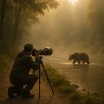
Every JPEG, RAW or video frame can embed latitude and longitude inside EXIF metadata. Once published online, that invisible pin becomes public knowledge. In fragile areas—think raptor nests, rare orchids or geological formations—one viral post often triggers a surge of foot traffic. Geotag security protects both subject and photographer.
- Conservation: Prevent habitat degradation, wildlife stress and plant poaching.
- Personal safety: Keep back-country camp spots and expensive gear routes undisclosed.
- Competitive edge: Guard secret locations that differentiate your portfolio from stock imagery.
Threat Scenarios You Might Overlook
Before you choose a protection tactic, map out real-world risks.
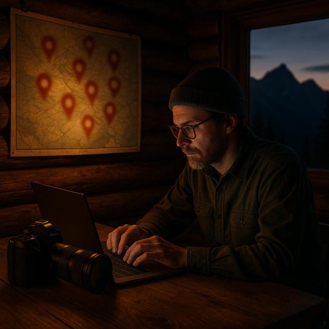
- Location scraping bots bulk-download social images and index coordinates.
- Reverse-image search sleuths combine public landmarks with pixel patterns to triangulate spots.
- Well-meaning followers ask “Where is this?” and crowdsource answers in comments.
- Geo-targeted ads prompt travellers to “visit hidden gems near you,” accelerating damage.
Understanding these angles helps you fine-tune how much to reveal and to whom.
Four Levels of Geotag Obfuscation
| Level | Goal | How It Works | Portfolio Impact |
|---|---|---|---|
| 1. Strip EXIF | Remove GPS entirely | Export via Lightroom “Exclude Location Info” | No location filters; fully safe |
| 2. Fuzz Coordinates | Show region, hide exact spot | Shift lat/long 10–50 km with ExifTool | Still searchable by state or park |
| 3. Time-Delay Release | Avoid real-time crowds | Publish weeks or seasons later | Minimal; story remains intact |
| 4. Private Galleries | Share exact data with vetted clients only | Password-protected galleries, NDAs | Full detail for buyers, none for public |
Level 1: Strip Everything by Default
For public social feeds, zero GPS equals zero risk. Lightroom, Capture One and even free tools like Darktable let you uncheck “Include Location Info” on export. Batch-processing maintains consistency across thousands of shots.
Level 2: Fuzz Coordinates for Regional Storytelling
Sometimes you need regional SEO juice—say you specialise in Scottish Highlands. Use ExifTool commands such as:
exiftool -GPSLatitude+=0.25 -GPSLongitude+=0.25 *.jpg
This adds roughly 28 km of error—enough to hide a nesting site while still letting directories index “Scotland.” Pair this with the visibility tactics from geo-tagged portfolio optimisation to stay discoverable without oversharing.
Level 3: Delay Posting & Disguise Seasons
Small shifts in foliage, snow cover or Milky Way position foil reverse-image tools. Publish after migratory birds have left or when flowers are no longer in bloom. This timing trick also gives you an editing buffer, so you can deploy cohesive series during quiet business months.
Level 4: Share Precisely, But Only With Stakeholders
High-value clients—tourism boards, scientific institutions—may request coordinates. Deliver them in a private PDF or secure gallery, and clarify usage terms upfront. Consider inspiration from drone regulation workflows where flight logs are locked behind NDAs.
Workflow: Publish Safely Without Losing Story
Below is a practical flow you can adapt to any project:
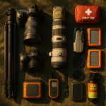
- Field Capture – Log raw coordinates in a note-taking app, separate from images.
- Ingest & Backup – Duplicate RAWs; label drives with shoot code names, not places.
- Select Level 1–4 – Decide protection tier before touching export settings.
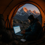
- Edit & Keyword – Use descriptive terms (“coastal basalt cliffs at dawn”) instead of GPS tags.
- Export Variants – Create two folders: Public (stripped/fuzzed) and Private (original).
- Publish – Upload public files to social, directories and your website.
- Archive – Store private originals off-line or in encrypted cloud for licensed deals.
Tools & Settings Checklist
- Lightroom Classic → Metadata panel → Remove Location Info on export.
- Adobe Bridge → Tools > Remove Location » batch processing.
- ExifTool GUI → “Shift” coordinates for fuzzing.
- Instagram → Turn off “Add to Photo Map” at upload.
- Twitter → Settings > Privacy > “Delete location information” for all past tweets.
- WordPress plugins → “EWWW Image Optimizer” can strip EXIF automatically.
Balancing SEO & Conservation
Search engines still index alt text, captions and page context. Focus on vivid storytelling and regional keywords to replace exact GPS. When writing directory entries, reference larger protected areas (“Great Smoky Mountains National Park”) instead of coordinates. Complement this with ethical statements similar to those in responsible landscape imagery codes to reassure eco-conscious clients.
Smart Client Communication
Some buyers may insist on pinpoint locations for reshoots or licensing. Counter with:
- A clause stating coordinates are supplied post-purchase under NDA.
- An offer to guide their crew on-site, adding value and guaranteeing minimal impact.
- Alternative sites with easier access if conservation rules forbid disclosure.
Clear communication elevates your professional standing and aligns expectations early.
Mini Quiz: Check Your Geotag IQ
FAQ
- Does Instagram still keep GPS data after posting?
- Recent versions strip coordinates from public images, yet third-party apps accessing your library may still read them. Always export stripped files first.
- Will removing EXIF hurt my ranking in photo directories?
- No. Most directories rely on tags, captions and category fields. Clean EXIF actually speeds page loads, aiding SEO.
- Is fuzzing coordinates legal?
- Yes. You own the metadata and may alter it. Just avoid misrepresenting shots in paid advertising.
- How can I verify my files are clean?
- Use a free checker such as Jeffrey's Image Metadata Viewer. Drag your export in; if no GPS fields appear, you're safe.
- Should I watermark location info onto the image?
- Better not. Text can be cropped out, and it invites casual viewers to Google the place. Keep sensitive data separate.
Next Steps
Apply Level 1 stripping on your existing portfolio today. Then audit past posts, update captions and deploy the secure workflow for all future shoots. If you plan to monetise location-based projects, pair these tactics with the seasonal planning advice in weather-intelligent scheduling to maximise both safety and revenue.
Ready to turn secure, eco-friendly nature images into paid assignments? Update your directory profile now and pitch clients who value conservation as much as aesthetics.