Responsible landscape imagery: code of ethics for working in fragile ecosystems
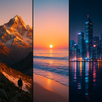
Shooting in alpine meadows, coastal dunes or desert biomes delivers breathtaking visuals—but one careless step can trigger erosion or disturb endangered species. This guide sets out a practical code of ethics for responsible landscape imagery so you can capture beauty, protect fragile ecosystems and safeguard your professional reputation.
Why ethics matter when photographing fragile ecosystems
Fragile environments recover slowly. Trampled moss or disturbed nesting sites may take decades to heal. Ethical field habits minimise damage, maintain access rights and reassure clients that your work aligns with their sustainability commitments.
The five core principles of responsible landscape imagery
1. Minimise physical impact
Stay on durable surfaces, use existing trails and keep gear weight compact to avoid widening paths. Where no trail exists, spread out your team to disperse pressure instead of forming a new track.
2. Respect wildlife and plant life
Maintain recommended buffer zones—100 m for nesting birds, 25 m for most mammals. Schedule shoots outside breeding seasons and brief your crew with wildlife safety protocols to prevent stress-induced abandonment.
3. Protect sensitive location data
Fragile hotspots go viral fast. Strip GPS metadata before posting or share approximate regions only. For advanced workflows, follow the steps in this guide on geotag security.
4. Honour local and Indigenous communities
Seek permits, consult cultural custodians and credit their stewardship. Compensation or community donations demonstrate respect and foster long-term access.
5. Comply with laws and permits
National parks, private reserves and drone regulations each impose specific limits. Before lifting off, review current drone rules for outdoor shoots.
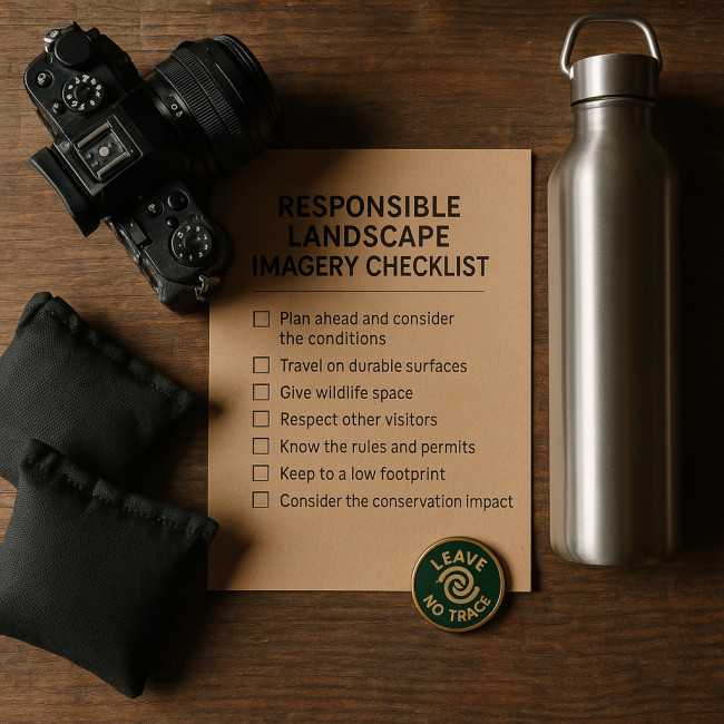
Pre-shoot ethical checklist
- Research protected species, trail closures and seasonal restrictions.
- Secure written permits for land access and commercial use.
- Plan low-impact routes and backup locations to avoid crowding.
- Pack reusable sandbags, ground cloths and trash sacks.
- Brief every crew member on site-specific risks and etiquette.
Field conduct: do's and don'ts
| Common scenario | Don't | Ethical alternative |
|---|---|---|
| Shooting wide vistas | Set up tripods on delicate tundra | Use board or snowshoe platforms to distribute weight |
| Lighting a night scene | Blast LEDs that disorient wildlife | Diffuse light, keep beams below horizon, limit duration |
| Changing lenses in sand | Open camera body in wind | Step into sheltered area or use changing bag to avoid micro-debris |
| Sharing locations online | Publish exact GPS in captions | List broad region or conservation district only |
| Drone fly-over | Hover above nesting cliffs | Maintain 120 m lateral buffer and cut prop noise time |
Post-production & distribution responsibilities
Ethical practice continues after the shutter clicks:
- Audit metadata for GPS, ranger permit numbers and private-land references.
- Add context that encourages stewardship—note trail conditions and Leave No Trace reminders.
- Fact-check captions with local experts to avoid misidentifying sensitive species.
- When submitting to editors, provide a usage note that limits location disclosure.
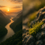
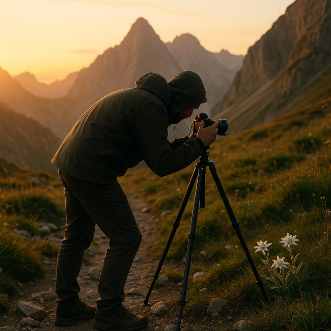
Case study: Alpine meadow sunrise shoot
For a tourism board brief, photographer Léa Martinez needed dawn light over a 2 650 m meadow populated by rare edelweiss. By applying the code of ethics, she:
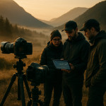
- Arrived via existing rock path, keeping four-person crew single-file.
- Used carbon-fibre tripods fitted with rubber feet to prevent soil puncture.
- Shoot timed before seed set to reduce trampling risk.
- Removed coordinates before delivery and labelled the series “Central Alpine Range.”
- Donated 5 % of her fee to the park's erosion-repair program.
The project impressed the client and secured a follow-up commission that centred on narrative planning—techniques she refined using storyboarding for nature series.
Tools, training and certifications
- Leave No Trace Photographer Course: covers impact minimisation principles in two hours.
- Global Mapper GIS: overlay conservation zones to plan low-risk routes.
- SkyTruth Alerts: monitor protected-area changes to adjust location choices.
- Eco-drone compliance log: records flight paths and mitigations for audit trails.
Responsible landscape imagery and your business growth
Brands increasingly vet suppliers for sustainability. Displaying your ethical stance on your portfolio and in talent hubs such as the landscape photographers directory builds trust and lifts shortlist rates. According to Artfolio analytics, profiles mentioning “Leave No Trace” receive 23 % more recruiter clicks than those that do not.
FAQ
- Do I need permits for non-commercial shoots?
- Many parks still require permits if tripods or drones are used. Check local regulations, even for personal work.
- Is editing out footprints considered unethical?
- Removing minor traces is acceptable if it avoids drawing attention to a fragile site. Never erase safety hazards or wildlife that were present.
- How far should I stay from wildlife?
- Follow species-specific guidelines; a minimum of 25 m for mammals and 100 m for nesting birds.
- What's the best way to share locations with clients securely?
- Use password-protected maps or general region descriptions in captions, then supply exact GPS in a private briefing only.
- Can ethical practice improve my SEO?
- Yes. Keywords like “responsible landscape imagery” and backlinks from conservation groups boost relevance and authority.
Test your knowledge
Key takeaways & next steps
Responsible landscape imagery hinges on foresight, respect and transparency. Integrate the code of ethics into your client proposals, publish your stance on your portfolio and encourage peers to follow suit. Ready to lead by example? Download our printable checklist and start planning your next low-impact shoot today.