GIS and drone mapping: elevate landscape proposals with data-rich visuals
Tired of clients doubting your vision? Integrate GIS and drone mapping into your landscape proposals and watch approval times shrink, budgets firm up and stakeholder excitement soar. This guide breaks down the datasets, workflows and persuasion tactics you need to turn raw spatial data into compelling, data-rich visuals.
Why GIS and drone mapping are changing landscape design
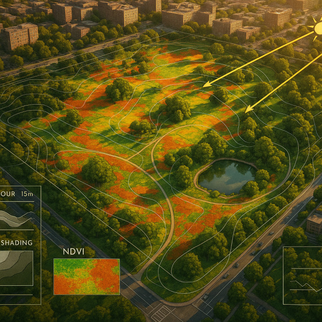
Traditional sketches and renders still have charm, but they rarely answer the two questions every decision-maker has: “Will this work here?” and “How much risk is involved?”. GIS and drone mapping remove guesswork by layering precise geospatial data on top of high-resolution imagery. The result: site-specific insights presented in a language even non-designers grasp immediately.
The limits of conventional visuals
- No elevation context means drainage and sight-line issues surface late.
- Stock aerial photos often fail to reflect current land use or vegetation cover.
- Inconsistent scales make it hard to compare design options side by side.
What data-rich visuals unlock
- Accurate cut-and-fill calculations that protect budgets.
- Vegetation indices (NDVI) that support urban biodiversity metrics.
- Real-time sun path simulations that validate seasonal shading concepts.
Five essential datasets to capture on every project
- High-density point cloud – Build a centimetre-accurate digital terrain model for grading studies.
- Orthomosaic imagery – Produce a true-scale base map to overlay planting plans and utilities.
- Multispectral bands – Reveal soil moisture and stress factors that inform species selection.
- Slope and aspect rasters – Identify microclimates and anticipate erosion risks.
- Heat-island hotspots – Support arguments for green roofs, water features and reflective materials.
Workflow: from flyover to polished board in seven steps
| Stage | Key Tool | Output | Typical Time |
|---|---|---|---|
| 1. Pre-flight planning | Mission Planner + GIS basemap | KML flight path | 30 min |
| 2. Drone data capture | RTK quadcopter | RAW imagery & GPS logs | 1-2 hrs |
| 3. Photogrammetry | Agisoft Metashape | Orthomosaic, point cloud | 4 hrs (automated) |
| 4. GIS post-processing | QGIS | Contour lines, slope maps | 1 hr |
| 5. Design overlay | Vectorworks Landmark | Planting & hardscape layers | 3 hrs |
| 6. Visual storytelling | Illustrator + InDesign | Boards & animated GIFs | 2 hrs |
| 7. Review & export | PDF & WebGL viewers | Interactive package | 30 min |
Cost–benefit snapshot
Below, a quick glance at equipment tiers helps you justify investment faster.
| Budget | Drone & Sensor | GIS Software | Break-even (projects) |
|---|---|---|---|
| Starter (€2 500) | Mavic 3E, RGB only | QGIS (open-source) | 3 small parks |
| Pro (€7 900) | DJI Matrice + RTK | ArcGIS Pro | 1 medium campus |
| Enterprise (€18 000) | WingtraOne + multispectral | ArcGIS + Drone2Map | 1 regional masterplan |
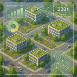
Visual proof: data-rich proposals win more bids
Source : ASLA Industry Insights
Persuading stakeholders with layered evidence
Numbers matter, but the narrative seals the deal. Blend quantitative insights with aspirational storytelling:
- Highlight ROI: Cite reduced maintenance costs thanks to precise grade modelling.
- Use before-and-after sliders: Show current orthomosaic versus greened scenario.
- Embed route simulations: Short videos exported from GIS help boards come alive. For extra inspiration, review our drone imagery portfolio trends.
Common hurdles and how to avoid them
Regulatory headaches
Check local aviation authority rules and secure at least one pilot with a Remote ID or equivalent certification. Planning a large public artwork? Leverage seasonal site scouting early to align drone windows with weather and permit deadlines.
Data overload
Stakeholders love clarity. Cull redundant layers and use clear legends. A 3-layer rule (terrain, vegetation, design overlay) keeps eyes on what matters.
Hardware downtime
Pack spare batteries, props and at least one secondary UAV. If the site involves fragile ecosystems, discuss sustainable material sourcing strategies simultaneously to keep eco-credentials intact.
Your GIS & drone toolbox
- Hardware: RTK-enabled drone, ground control points, multispectral camera.
- Capture apps: DJI Pilot 2, DroneDeploy.
- Processing: Agisoft, Pix4D, ArcGIS Drone2Map.
- Design integration: QGIS, AutoCAD Civil 3D, Vectorworks Landmark.
- Presentation: InDesign, WebGL viewers, Power BI for metrics dashboards.
Mini quiz: test your spatial-data readiness
FAQ
- Do I need a pilot licence to use drones on paid landscape projects?
- Yes. Most countries require a remote pilot certificate for commercial flights. Check local aviation authority guidelines.
- Can open-source GIS replace premium suites?
- For basic mapping and layer styling, QGIS works well. Large enterprises often pair it with ArcGIS for networked asset management and client-facing dashboards.
- How much storage do I need for one hectare of high-resolution mapping?
- Plan for roughly 3–5 GB once imagery, point clouds and rasters are processed.
- Which deliverable format impresses non-technical clients most?
- Interactive PDF with togglable layers or a lightweight WebGL viewer they can open in any browser.
Ready to elevate your next proposal?

By pairing GIS and drone mapping, you'll join an elite group of spatial designers trusted for data-backed creativity. Start small: capture a single orthomosaic on your upcoming bid, then layer insights as your confidence grows. Want an immediate wow factor? Review drone flyovers for land art and apply the same aerial storytelling to your green spaces.
Take action: Block two hours this week to plan your first mapping flight, tag a pilot, and sketch out the three layers you'll showcase. Your next win may be just one data-rich board away.


