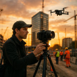
Drone workflows that elevate architectural photography for property marketing
Want listings that stop the scroll and spark more qualified enquiries? Mastering a repeatable drone workflow lets you frame every building at its most desirable angle, turn routine exteriors into cinematic brand assets, and boost the ROI of property marketing campaigns.
Why drones redefine architectural photography for real-estate teams
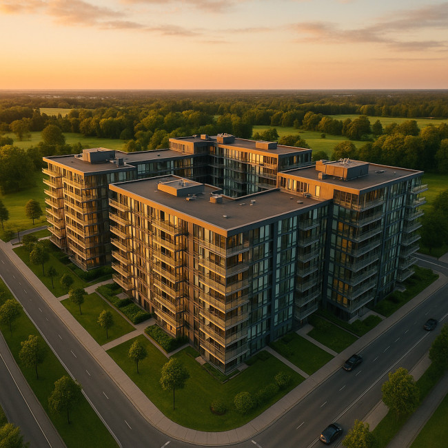
Drones extend the visual narrative beyond ground level. They deliver three competitive advantages: unbeatable vantage points, immersive context, and measurable engagement lifts. According to the National Association of Realtors, listings that feature aerial imagery capture 68 % faster sales cycles and up to 32 % more online views.
Beyond hero shots: contextual storytelling
- Show the full plot line, neighbour amenities, and access roads in one frame.
- Add elevation data to stand out in interactive brochures or 3D site maps.
- Combine dusk flyovers with interior light spills for an emotional hook.
The 5-phase drone workflow that keeps shoots efficient and compliant
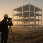
1. Pre-flight research and permits
Begin with local airspace checks (FAA LAANC in the US, EASA UAS Geographic Zones in Europe) and property owner consent. Build a checklist inspired by our site-scouting guide for architecture shoots. Secure:
- Flight authorisation for altitude and proximity limits.
- Liability insurance that mentions aerial operations.
- Take-off and landing zones clear of pedestrians.
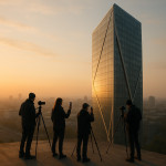
2. Sun-path and weather alignment
Download real-time METAR data and use sun-tracking apps such as SunCalc. Aim for golden or blue hour to reduce harsh shadows. Sync this plan with the ground photographer so light temperatures match across media.
3. Shot-list mapping and flight-path programming
Translate the estate agent's selling points into coordinates. Orbit paths highlight façade symmetry, while waypoint missions reveal site symmetry. If you need cinematic flyovers, revisit our drone flyover techniques for smooth parallax.
| Objective | Flight Pattern | Recommended Altitude | Deliverable |
|---|---|---|---|
| Facade hero image | Single waypoint hover | 20 m | 6K still |
| Site overview | Spiral ascent | 60 m | Orthomosaic |
| Neighbourhood context | Linear reveal | 90 m | 15 s 4K clip |
| Virtual tour tie-in | 360° orbit | 40 m | HDR panorama |
4. Capture optimisation
- Use D-Log or D-Cinelike profiles to preserve dynamic range.
- Bracket exposures ±2 EV for later HDR merges.
- Set gimbal pitch to ‑5° to straighten vertical lines at mid-altitude.
- Record gyro data; it accelerates post-stabilisation.
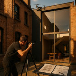
5. Post-production and delivery
Import RAW stills into Lightroom Classic; apply lens-profile corrections and match colour science to ground images to avoid jarring tone jumps. For videos, stabilise using ReelSteady or DaVinci Resolve's stabiliser, then colour-grade with your LUT library. Need help fixing leaning facades? Our architecture post-production checklist covers vertical correction tricks.
Integrating drone visuals into your marketing funnel
A. Interactive listing pages
Embed orbit clips as autoplay-muted headers. Pair with a professional architecture photographer directory profile to add social proof.
B. Print brochures with scale cues
Use annotated orthomosaics to illustrate plot boundaries, parking access, or zoning perks.
C. Social-first teasers
Trim 6-second vertical ascents for Reels or TikTok. Add speed-ramping to underline modernity.
D. 3D mapping and VR walk-throughs
Combine photogrammetry from your flight logs with GIS data. Our article on GIS-enabled drone mapping explains ground-control-point workflow.
Performance metrics you should track
Source : National Association of Realtors
Common pitfalls and how to avoid them
- Over-editing skies: Keep cloud texture; buyers notice fake gradients.
- Noisy footage: Use ND filters to maintain 1/60 shutter on sunny days.
- Ignoring regulations: Hefty fines erase marketing gains. Always log flights.
Self-audit checklist
- Have you matched kelvin values between aerial and interior shots?
- Is every still geo-tagged for GIS integration?
- Did you export 4K H.265 at 100 Mbps for streaming optimised quality?
Ready for a quick test?
FAQ
- Do I need a pilot licence to fly drones for commercial real-estate photos?
- Yes. Most jurisdictions require a remote pilot certificate (Part 107 in the US) and insurance when flying for profit.
- What is the ideal resolution for listing portals?
- Upload 4K videos and 24 MP stills; portals downscale automatically while retaining clarity on high-dpi screens.
- How many aerial photos should a listing include?
- Three to five. One hero, one context, one amenities, plus optional dusk and neighbourhood shots.
- Can drones replace ground photography?
- No. Aerials complement but do not capture interior details or human-scale textures.
- How long does a typical drone shoot take?
- For a single property, plan 90 minutes: 30 minutes setup, 30 minutes flight, 30 minutes contingency.
Take action
Ready to elevate your portfolio? Browse the architecture photographer hiring checklist, shortlist a certified pilot from the architecture photographers directory, and start winning more property briefs today.